There are numerous options for 3D photogrammetry software for drones. Many 3D mapping drone services companies offer a free version or a free evaluation period, allowing you to test the software before making a purchase. The various photogrammetry software packages can then be compared.
We review the best photogrammetry software for creating 3D maps and models on the market below, complete with videos.
Along with 3D mapping software, some providers offer full aerial mapping solutions that include drones, mapping software, and even training.
If you do not feel the need to own a drone, you can rent professional 3D mapping services.
Many photogrammetry software companies also offer cloud hosting or data warehousing for your 3D maps and models. Photogrammetry software can generate large files, depending on the number of images and their resolution.
Building 3D maps from images take a lot of computer processing power and can take a long time on a standard computer. Many of the photogrammetry software companies listed below have backup systems in place for your 3D maps and models.
Let’s take a look at some of the best 3D mapping drone service solutions on the market.
Photogrammetry Software at its Finest
Here is the top photogrammetry software on the market for creating 3D models drones services. These photogrammetry software solutions work with both ground-based and aerial images captured by drones. These 3D photogrammetry software solutions are discussed further below.
DroneDeploy’s mobile 3D mapping app
DroneDeploy Enterprise 3D Map Pix4DMapper photogrammetry
- Photogrammetry with AutoDesk ReCap
- Maps Made Easy orthophoto and 3D models with SimActive Correlator3DTM software
- 3DF Photogrammetry software Zephyr
- Photogrammetry with Agisoft PhotoScan
- 3D model drone service software PrecisionHawk
- Photogrammetry with Open Drone Map
- Agisoft Metashape 3D software ESRI Drone2Map for ArcGIS
- Providers of 3D Mapping Solutions
Here are the best drones for 3D map creation, surveying, and geographic information system work near the end of this photogrammetry software post, as well as 3D mapping companies that provide solutions to complement the photogrammetry software.
- Aerial Mapping Solutions by SenseFly
- WingtraOne Survey Mapping Software
- Arcadis Photogrammetry and 3D Modeling software for DJI GS Pro
Before we get into the best 3D photogrammetry software and solution providers on the market, let’s define the 3D mapping.
What Exactly Is 3D Mapping?
The science of making measurements from photographs is known as 3D mapping, also known as photogrammetry mapping. Photogrammetry software typically produces a 3D map, a 3D drawing, or a 3D model of a real-world object or land mass.
How to Make 3D Models drone service and Maps
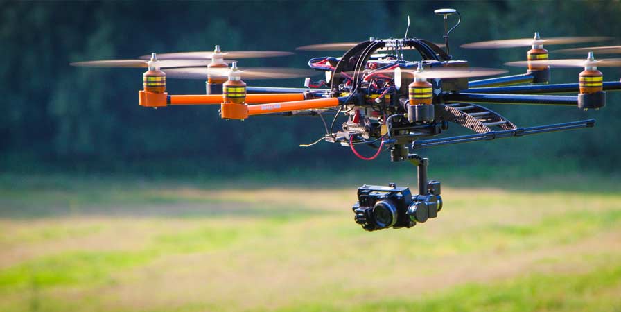
A camera mounted on a drone or aircraft and pointed vertically towards the ground is used to create a 3D map of a land mass from aerial photos. The camera is mounted horizontally to create a 3D model of a monument, statue, or even a face.
The drone camera will take hundreds, if not thousands, of photos of the ground, structure, or model. The photos will overlap with an overlap of 80 to 90%. Aerial image stitching photogrammetry software is then used to create the 3D map or 3D model.
The drone will fly using waypoints, which are autonomously programmed flight paths. Using pilot navigation, it would be impossible to overlap photos of an object or land mass by 80 to 90%. It is critical to have a drone equipped with waypoint navigation technology.
Best 3D Mapping Drones
- Aerial Mapping Solutions by SenseFly eBee
The SenseFly eBee is a fully autonomous, user-friendly mapping drone. It is used to take high-resolution aerial photos, which are then converted into accurate orthomosaics and 3D models.
- Drone for 3D Mapping and Surveying WingtraOne
The WingtraOne is a vertical take-off and landing drone designed specifically for surveying and creating 3D maps.
The WingtraOne’s vertical take-off and landing capability allow it to ascend and move like a helicopter. It enters forward cruise flight for the mapping mission, matching the endurance and speed of fixed-wing airplanes. To land, the WingtraOne returns to hover flight and descends vertically.
- Drones from DJI for 3D Mapping
DJI recently introduced the Mavic 2 Pro and Mavic 2 Zoom. Both of these new Mavic 2 editions outperform the Mavic Pro in every way. They fly longer, and have better stabilization, and cameras, making them ideal for 3D mapping.
The DJI Phantom 4 Pro is currently one of the 3D mapping drone service providers. It has an excellent camera, flies extremely well, and has a plethora of intelligent flight modes. It is compatible with all of the above-mentioned photogrammetry software, including DroneDeploy Mobile App, Pix4DMapper, Maps Made Easy, and Open Drone Map.