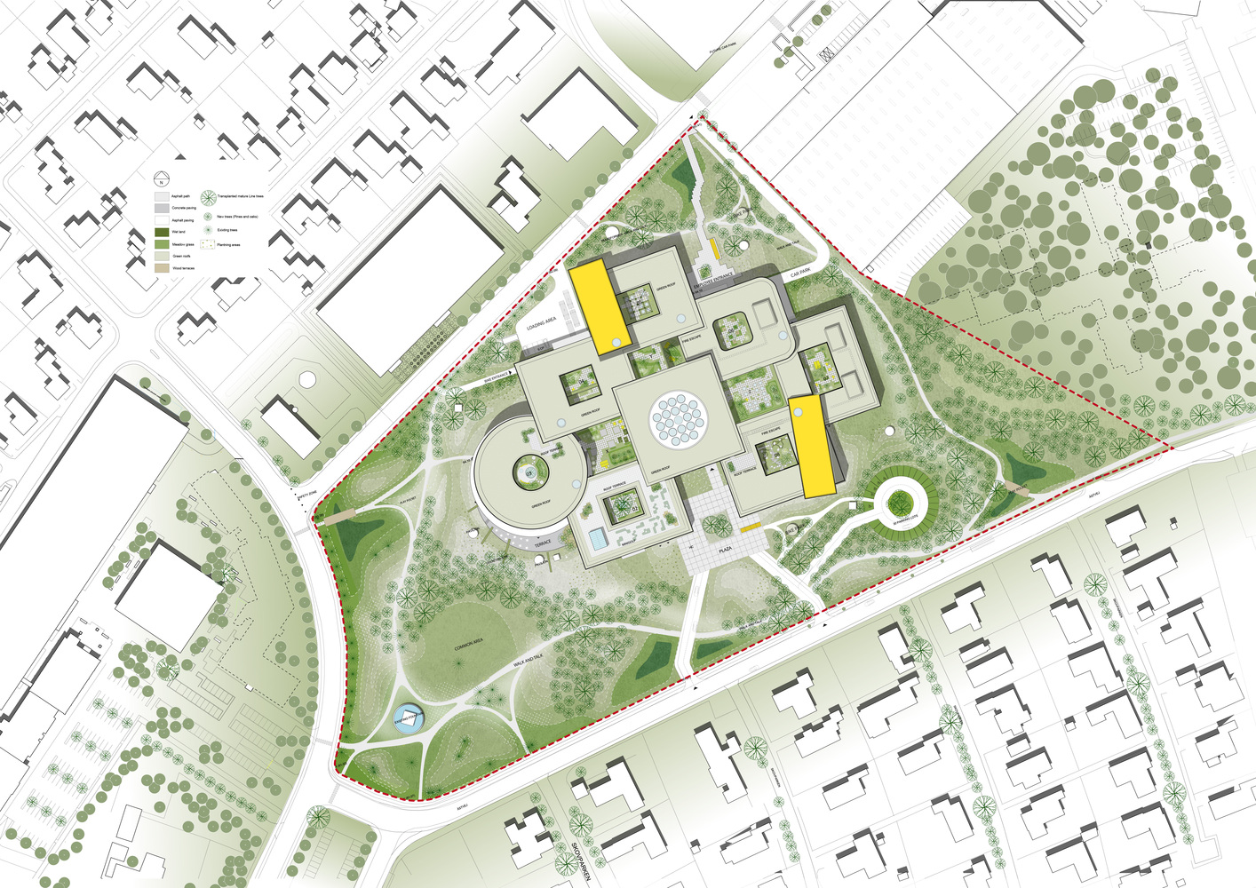
When constructing new buildings and in the event of changes to the existing building with an effect on neighboring properties, the building permit authority usually requires an official site plan in accordance with Section 3 of the Building Inspection Ordinance. These plans are produced on a scale of 1:200 or 1:250 and are part of the building plans to be submitted by the architect.
We create official site plans by taking local measurements of the building plot according to position and height, obtain the planning law applicable to the plot and transfer all information relating to the plot to the planning basis. This plan is sent to the architect as a preliminary draft so that he has all the general conditions of the property, both building law and property-related, available. The architect’s special requests, which are relevant to planning and utilization, are discussed and fulfilled in advance.
This is the case, for example, if there is no qualified development plan and the admissibility of the planned construction project results from the character of the surrounding buildings (§ 34 BauGB “Within the connected built-up districts, a project is permitted if it fits in with the characteristics of the surrounding area in terms of the type and size of the structural use, the type of construction and the area of the property that is to be built over and access is secured. …”.). For this purpose, height information and storey levels of existing buildings in the extended area (radius ~ 200 m) are to be measured and, if necessary, their property utilization is to be documented.
The data of the reference objects located at a distance from the actual building site are, for example, transferred to the official cadastral map or entered into digital images as the necessary evidence. This data is recorded as part of the larger-scale Site plan. For this purpose, height information and storey levels of existing buildings in the extended area (radius ~ 200 m) are to be measured and, if necessary, their property utilization is to be documented. The data of the reference objects located at a distance from the actual building site are, for example, transferred to the official cadastral map or entered into digital images as the necessary evidence.
This data is recorded as part of the larger-scale site plan. For this purpose, height information and storey levels of existing buildings in the extended area (radius ~ 200 m) are to be measured and, if necessary, their property utilization is to be documented. The data of the reference objects located at a distance from the actual building site are, for example, transferred to the official cadastral map or entered into digital images as the necessary evidence. This data is recorded as part of the larger-scale site plan.
According to Section 3 of the Building Inspection Ordinance, the official site plan has the following content:
- Presentation of the building plot and the neighboring buildings with ownership, land register and address information
- Dimensioning of the lawful boundaries of the property and its size
- Terrain height conditions and, if necessary, determination of the height of existing buildings with description, number of storeys, wall and ridge heights and determination of the distance areas
- Width and height of adjacent public areas and their topography (all planning-relevant components of the street space such as trees, lights, parking bays, water and gas valves, gullies, manhole covers with height information and floor height information, etc.)
- The designation of the development plan or the designation of other statutes according to the Building Code with the stipulations regarding the type and extent of the structural use, the construction method, the presentation of building lines and building boundaries and the areas on the building plot for which the development plan makes special determinations, as well as the designation of the local building regulations.
- Representation of monuments and protected tree stocks with indication of the trunk circumference at a height of 1 m and the crown diameter
- Provided that it can be read from the supplied land registers, areas secured under private law by easements
- Areas on the property that are publicly and legally secured by building encumbrances, i.e. loads and building encumbrances in favor of the building plot on neighboring properties.
The architect receives this synopsis of locally determined data and collected planning law stipulations and other legal specifications as a planning-determining, property-related preliminary draft for the official site plan as a planning basis for his draft planning.
After the plan has been drawn up, we receive the architectural documents that are ready for submission, which we then incorporate into the plan and process further:
- The new planning is entered in the site plan with details of the external dimensions, the shape of the roof, the wall and ridge heights, the height of the ground floor, the boundary distances, the depth and width of the distance areas determined by us and the distances to other structures and to public traffic areas.
- With the entry and the calculations required for this, there is often a further need for internal coordination with the planning colleague, which then leads to plan changes, plan supplements or the formulation of deviations and applications for a waiver. Of course, I am then also available for further advice and for participation in planning and coordination talks with the administration to enforce the planning within the legally permissible framework.
Official site plans are also created by us in other different forms – depending on the purpose and requirement.
Among other things, the area of the application property, the standard land value and the other necessary services to be provided are taken as a basis. A statement about the costs incurred can therefore only be made for a specific case. For this reason, please contact my office personally.


